

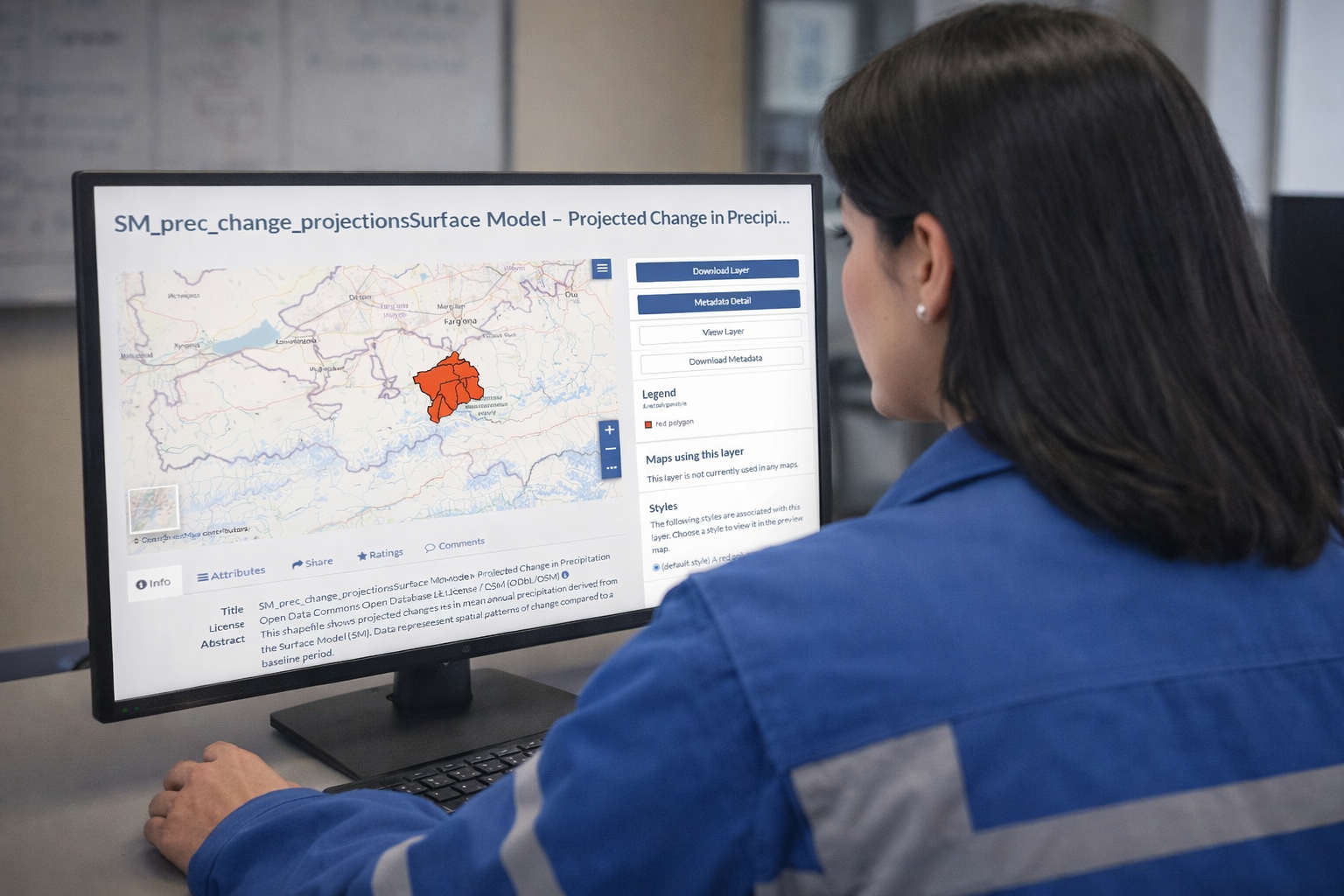
The Potsdam Institute for Climate Impact Research (PIK) has adapted the SWIM model to provide long-term and seasonal water availability forecasts for the Ugam, Zeravshan, and Amu Darya river basins. The simulation results, provided as shapefiles with attribute tables of climatic parameters and river discharge, are available online via the CACIP portal. This work is the result of cooperation between GIZ, hydrometeorological services of Central Asian countries, and PIK under the CRM CA programme.
In the context of climate change, understanding how the region’s water resources will shift is vital. The Soil and Water Integrated Model (SWIM) is a specially designed tool that allows for the assessment of future changes in river runoff, enabling timely management decisions.
“The activities of hydrometeorological services are primarily focused on seasonal runoff forecasts, whereas long-term modelling using SWIM promotes a deeper understanding of processes within the region’s river basins. The adaptation of any model is of higher quality when there is a collaborative effort between PIK scientists and local hydrologists who have experience with the specific river and understand the observational data including any issues or data gaps,” shared Aigerim Bolatova, Water Resources Advisor at GIZ. “At GIZ, we provided technical support for this work both online and through in-person meetings between the Hydromets and PIK to discuss simulation results at every stage. This experience fosters closer, long-term cooperation between practitioners and scientists.”
SWIM is a process-based semi-distributed eco-hydrological model designed for the integrated modelling of river basins. Developed at PIK, it has been applied to over 70 rivers across Europe, Africa, Asia, America. The model is used to address various hydrological challenges, including floods, droughts, reservoir and hydroelectric plant operations, as well as crop yield and irrigation modelling.
SWIM utilises a range of climatic and spatial data overlaid as layers. It operates on a daily time step and is typically used for medium-scale basins (~1,000 square kilometres). A river basin is divided into sub-basins, which are further broken down into hydrotopes – elementary units with uniform soil, vegetation, and topography. Key parameters (e.g., evaporation, infiltration, and runoff) are calculated at the hydrotope level before the results are aggregated for the entire river.
“Essentially, we need to create a digital twin of the river. Once the main parameters are calibrated, the model can simulate the processes occurring within the basin,” explained Iulii Didovets, Hydrological Modelling Expert at PIK. “Since this is a process-based model, it calculates various internal physical processes. For example, how precipitation in the form of rain or snow eventually transforms into river runoff or what’s the specific contribution of glacial melt.”
The complexity of SWIM, combined with available climate data, allows the model to operate across three hydrological forecasting horizons: short-term (up to 10 days) for operational management; seasonal (up to 9 months); and long-term for assessing climate impact on water resources. Beyond runoff forecasting, SWIM’s vegetation modules allow for the assessment of crop yields, making it an essential tool for climate change adaptation planning.
“The defining feature – and simultaneously the limitation – of climate scenarios is that we cannot know the exact temperature or rainfall for a specific day in the future. However, based on these scenarios, we can project the trajectory of the climate system and, in combination with the hydrological model, its impact on water resources: the overall water availability and whether droughts or floods will become more frequent over the coming decades,” Didovets concluded.
A note for specialists
Long-term modelling based on climate scenarios for the Amu Darya and Zeravshan basins through to the end of the 21st century indicates that the intra-annual distribution of runoff will change significantly.
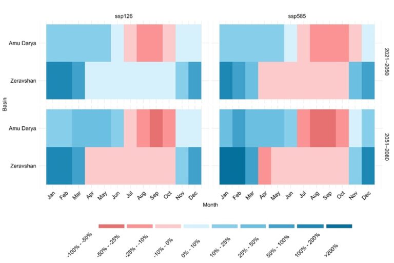
In almost all scenarios and periods, an increase in runoff is observed in late autumn, winter, and early spring. Conversely, in the Amu Darya basin, runoff decreases from July to October, while in the Zeravshan basin, it decreases from April to October in nearly all cases. These changes are linked to rising temperatures and seasonal shifts in precipitation (decreases in summer and increases in winter), which accelerate early snow and glacier melt and shift runoff seasonality.
Such shifts pose serious risks to the agricultural sector, as the reliability of water for irrigation could be substantially undermined.